CHALLENGE
The project’s main challenges are related to the acquisition and processing of images acquired by nano-satellites, an emerging technology for collecting remote sensing images, which does not yet have well-defined processing protocols and few references in the literature.
DEVELOPMENT
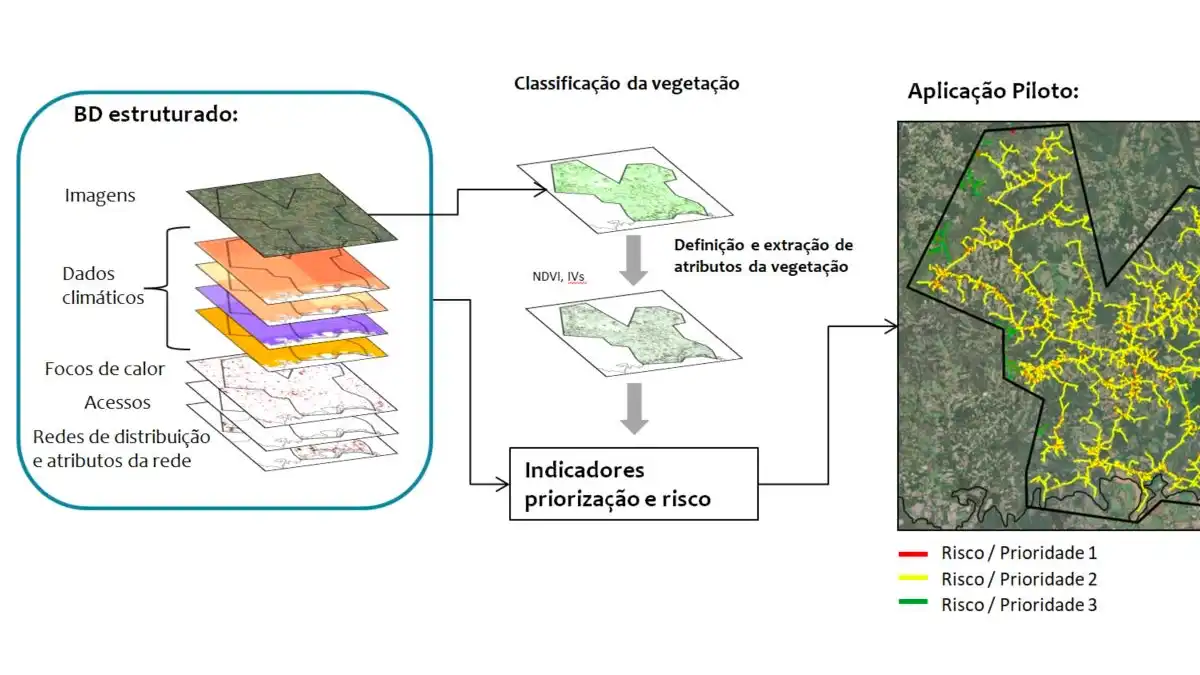
The development of the project is structured in 5 stages: (1) Survey of requirements and suppliers; (2) Acquisition of images and structuring of the database; (3) Testing of algorithms for classification of vegetation; (4) Extraction of attributes of interest; (5) Development of risk indicators and prioritization for management. Among the technologies used in the development of the project are multispectral images collected by nanosatellites, an emerging Earth observation technology that has seen a growing number of commercial companies supplying images and products in recent years. In addition, digital processing techniques, machine learning and deep learning algorithms, and geoprocessing techniques are used.
RESULT
The main product of the project is a protocol describing all the stages of the methodology developed, from the processing of nano-satellite images to the calculation of risk indicators and prioritization for vegetation management. The protocol being developed will also be applied in 4 pilot areas in the state of Paraná (approximately 3000 km²).


