Remote sensing monitoring
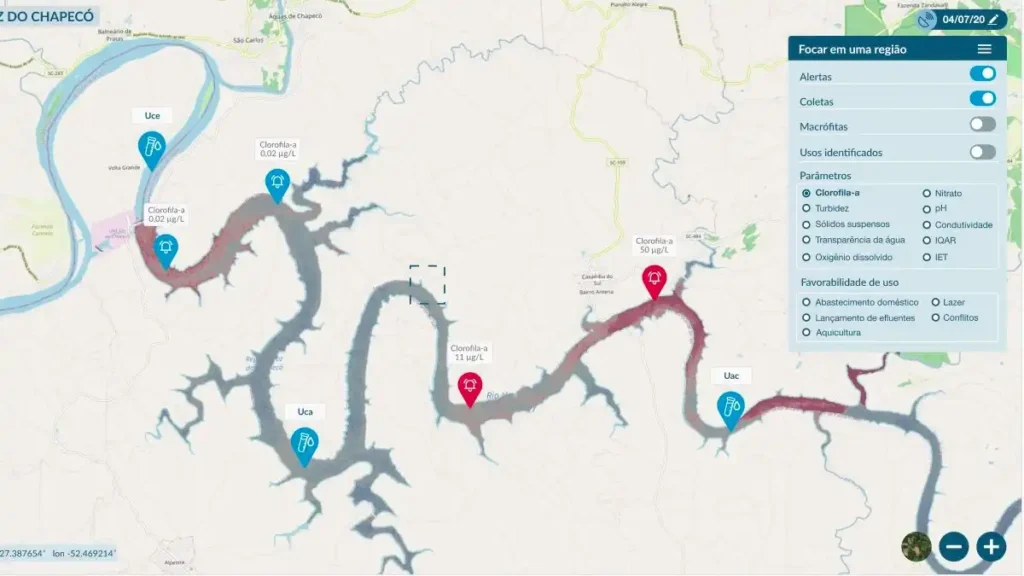
The project involves not only the development of the system, but also the collection of data and all the necessary steps to adjust and validate specific models for the Foz do Chapecó reservoir. With regard to the customization of models for the reservoir, one of the main challenges is obtaining the in situ data needed to adjust and validate the models, which must be concurrent with the satellite passes and follow an acquisition protocol aimed at data quality.
